Bicycle Tour: Cape Cod, Day Five
I rode 31 miles in the rain from North of Highland Camping Area to Nickerson State Park.
Sunday, September 7, 2025, was the fifth day of my tour of Cape Cod.
I slept well and woke this morning (Sunday) at 4:45 a.m. I had plenty of time before leaving because I was riding only about 30 miles, and check-in time at Nickerson State Park was at 1:00 p.m. I thought I would need three and a half hours to ride to my destination.
I was obsessed about energy for recharging my electronics since from this point on I was going to be dependent on charging my powerbanks using the dynamo hub on my bicycle. Because of my diligent charging efforts yesterday, I had three fully-charged 10,000-mAh powerbanks. I charged my watch and phone, using about 40% of the capacity of one powerbank. When the recreation hall at the campground opened at 8:00 a.m., I began topping up that powerbank, knowing there was not enough time to recharge it completely.
The weather forecast was for rain most of the day. I was lucky because the rain waited until about 10:45 a.m., just as I was finishing packing up. I managed to keep everything dry except the rainfly of my tent. I did not put on rain gear because the temperature was about 70 °F, and I knew that I would be soaking wet no matter what after thirty miles of riding.
I exited the campground and rode towards Head of the Meadow Beach. I turned right onto the bike trail — variously called “Head of the Meadow Bicycle Trail Connector” or “Old Kings Highway,” depending on which map I used — and followed the trail to Coast Guard Dr. I continued on Coast Guard Dr until I turned west on Highland Rd, which I followed into Truro and the intersection with Route 6A. I went this way because Highland Rd crosses under Route 6, whereas the East Coast Greenway route recommends taking South Highland Rd to Route 6 where I would have to cross Route 6 where traffic can be fast and heavy.
Turning left on Route 6A, I rode past Truro Vineyards on the left and continued to the junction with Route 6. This section of Route 6 has a bike lane, but the traffic whizzes by at 55 mph or faster. It was raining pretty hard, and there was a lot of water on the highway.
Following Bicycle Route 1 and the East Coast Greenway, I turned right off Route 6 onto Castle Rd. I followed Castle Rd to Truro Center Rd (see the photo below), turning right and continuing a little until I reached the intersection with South Pamet Rd.
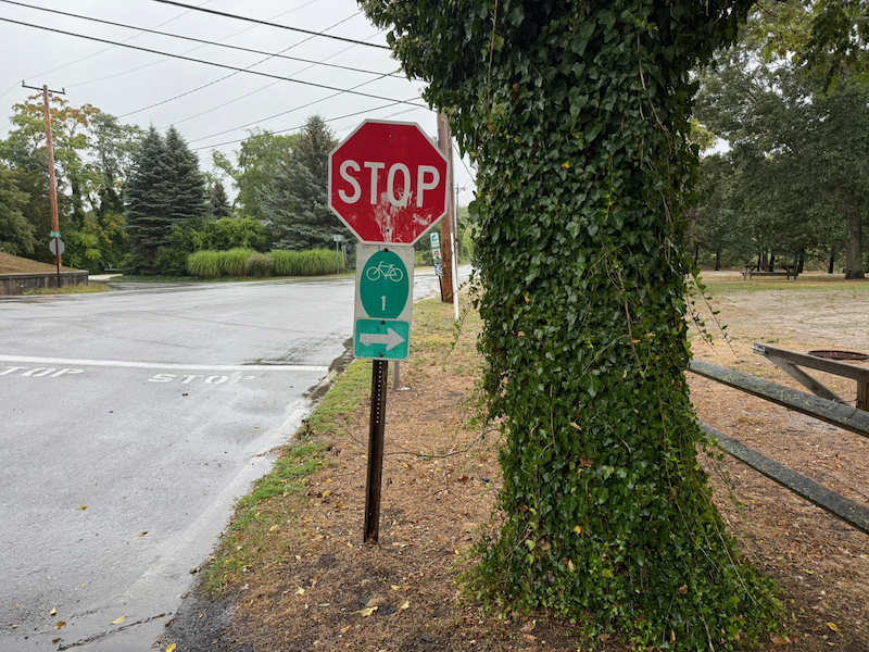 Bicycle Route 1 Sign on Castle Rd at Truro Center Rd
At this point, I left Bicycle Route 1 and the East Coast Greenway by turning left onto South Pamet Rd. After going under Route 6, I bore right to continue on South Pamet Rd. I followed this until turning right onto Collins Rd, which was freshly paved and easy to ride. I rode to the end of Collins Rd where it intersected with Route 6. It was still raining hard.
Near the intersection of Collins Rd and Route 6, to the left, was an unpaved single lane road, Slough Pond Rd. This road was difficult to ride because it was soft wet sand. I ended up pushing my bike in the rain for nearly three miles on single lane sand roads until I reached Ocean View Drive. These roads provide access to the cabins that are tucked in by the ponds. A lot of sand got into my brakes, and my rear brakes were becoming unreliable.
Back on pavement, I rode south on Ocean View Dr, which is part of Bicycle Route 1 and the East Coast Greenway. At the end of the drive, I turned right onto Lecount Hollow Dr. I took this to the Cape Code Rail Trail, where I turned left and headed south.
It was still raining, but not as hard as before. I love this section of the Cape Cod Rail Trail; the trail is straight and level. I had the illusion that I was riding downhill as I rode south. I saw six other people on loaded touring bikes riding north: a pair, a group of three, and a woman riding solo. We were all wet from the rain.
The Cape Cod Rail Trail enters Nickerson State Park on the north side of the park. I checked in at the park entrance and rode nearly four miles to Site 41 in Area 7. The park road rolls up and down on small hills. But by now my brakes weren’t working, so I had to walk my bike down the hills. I arrived at 3:45 p.m., four and a half hours after leaving, having covered a distance of 31.64 miles.
Area 7 had only a few occupants, and I had no neighbors. I set up my tent and got everything inside, then changed into dry clothes and a raincoat. I walked all of the roads in Area 7 and then ate dinner. It continued to rain steadily until about 9:00 p.m., with intermittent sprinkles until 2:00 a.m.
I managed my effort well on today’s ride, with 67% Zone 1, 23% Zone 2, and 10% Zone 3.